Log in
All resources
Create a design
9,296 Free Artworks of Map Collection
koninklijke bibliotheek
maps from university of amsterdam special collections
atlas der neederlanden
copperplate print
special collections of the university of amsterdam
eran laor cartographic collection
engraving on paper
bibliothèque nationale de france
maps by jakob van der schley
jakob van der schley
eran laor cartographic collection
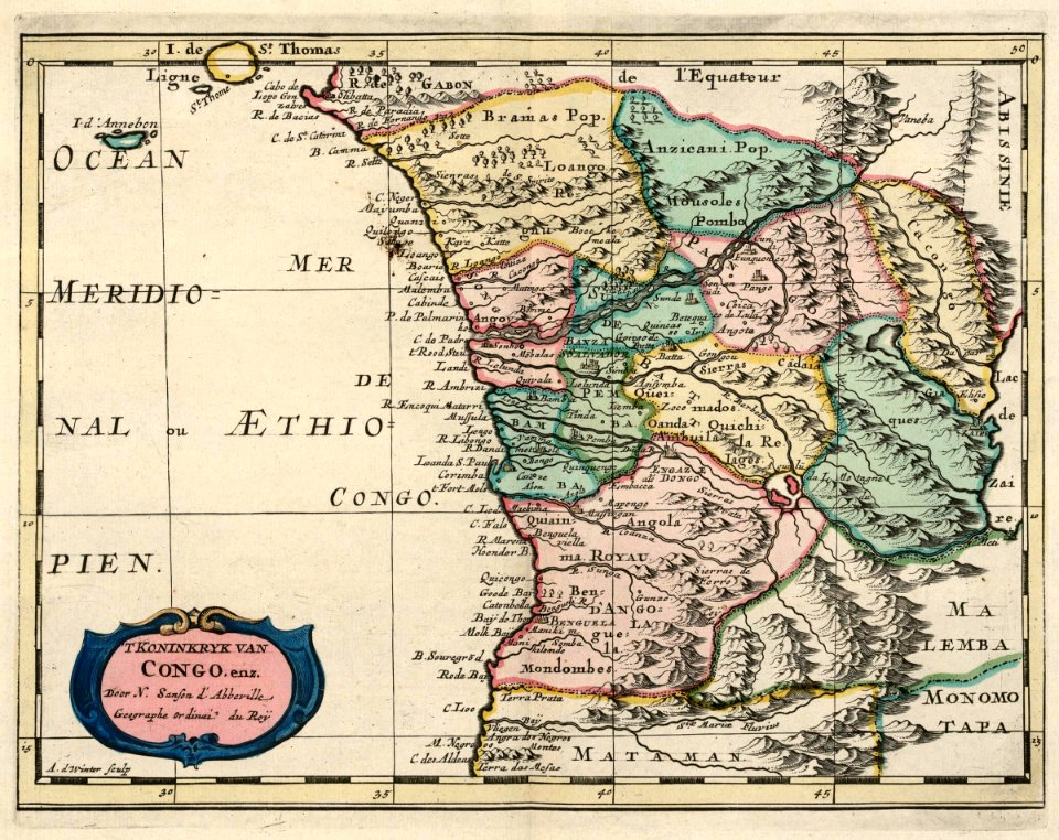
guillaume sanson
maps by frederick de wit
old maps of vollenhove
eran laor cartographic collection
afbeeldinge der stad jerusalem
amérique méridionale (1748, d'anville)
rococo
atlas van der hagen (volume 2)
atlas van der hagen
print room of the university of antwerp
plattegrond van antwerpen
drawings in the museu antônio parreiras
colored pencil
maps of the duchy of mantua
guillaume sanson
19th-century maps of england and wales
maps in the british museum
maps in the british museum
james basire
glaciers and glaciation (1910)
hubbard glacier
maps in the british museum
james basire
eran laor cartographic collection
baroque
atlas van der hagen (volume 4)
atlas van der hagen
eran laor cartographic collection
afbeeldinge der stad jerusalem
maps in the staats- und universitätsbibliothek hamburg
maps of hamburg-altstadt
maps of amsterdam in the rijksmuseum amsterdam
map of amsterdam, 1544
glaciers and glaciation (1910)
maps of glaciers of alaska
jodocus hondius ii, nova totius terrarum orbis geographica ac hydrographica tabula, 1636
map
eran laor cartographic collection
pierre mortier
maps made in the 17th century
nivernais (ducato)
maps from géographie illustrée de la france et de ses colonies
orientalist painting
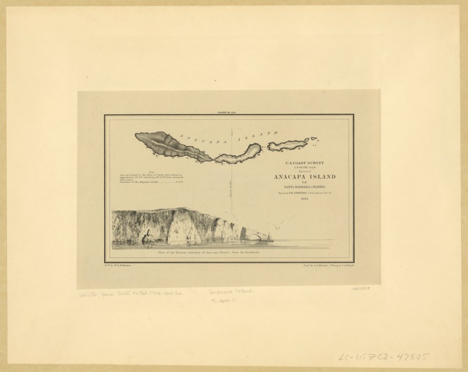
maps in the library of congress
1639 maps of cuba
maps by thomas kitchin
1782 maps of africa
maps of the dutch east india company - korea
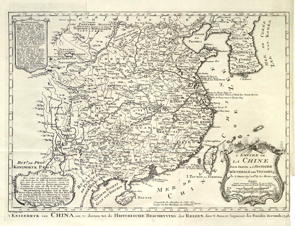
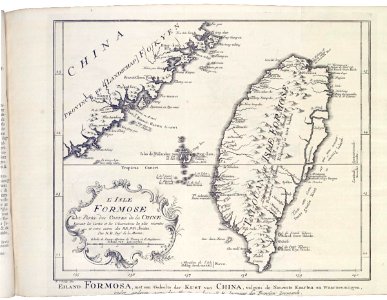
maps of the dutch east india company - china
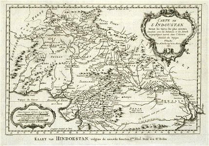
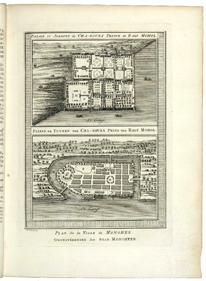
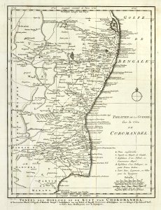
maps of the dutch east india company - india
1755 maps
maps of the dutch east india company - indonesia
maps by jakob van der schley
maps of the dutch east india company - india
1755 maps
old maps of the dutch east india company
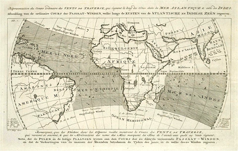
1760s maps of the atlantic ocean
eran laor cartographic collection
thomas starling
eran laor cartographic collection
thomas starling
maps of the kingdom of jaén (crown of castile)
maps of spain by tomas lopez
maps of the kingdom of córdoba (crown of castile)
maps of spain by tomas lopez
fine prints in the library of congress
aestheticism
drawings in the museu antônio parreiras
colored pencil
drawings in the museu antônio parreiras
colored pencil
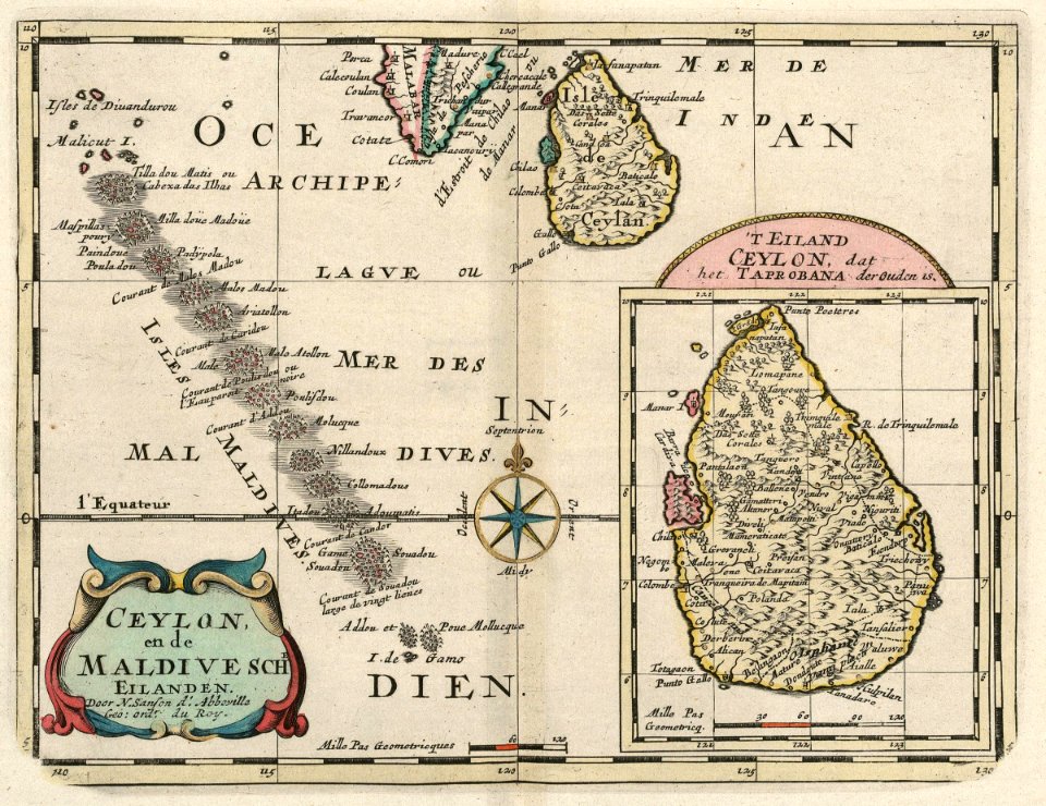
maps of the dutch east india company - sri lanka
maps of the dutch east india company - maldives
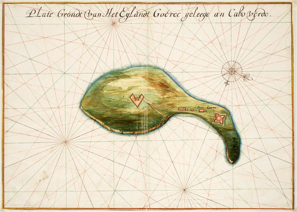
maps of the west-indische compagnie
1705
old maps of the tuamotus
old maps of polynesia
old county maps of oxfordshire
bodleian maps collection
media from the national library of finland
classicism
media from the national library of finland
classicism
eran laor cartographic collection
giovanni maria cassini
david rumsey historical map collection
maps of rügen by eilhard lubinus
maps in the british museum
udenheim
maps from university of amsterdam special collections
atlas der neederlanden
key sheet of the turgot map of paris
maps of paris from paris musées
17th-century maps of sumatra
maps by gerard valck
17th-century maps of bourgogne
17th-century maps of france
maps by louis brion de la tour
1766 maps of africa
maps from university of amsterdam special collections
atlas der neederlanden
maps of the west-indische compagnie
1665
maps of erfurt by braun & hogenberg
maps of jena by braun & hogenberg
maps of the dutch east india company - india
dutch suratte
maps from university of amsterdam special collections
atlas der neederlanden
maps from the mechanical curator collection available to georeference
maps from the mechanical curator collection
carte de la mer mediterranée (1764) by roux
eran laor cartographic collection
eran laor cartographic collection
willem blaeu
eran laor cartographic collection
francesco valegio
eran laor cartographic collection
pierre aveline
maps by nicolas sanson
1730s maps of france
18th-century maps of the canary islands
maps of spain by tomas lopez
atlas maior, vol 6 (scotland and ireland) - joan blaeu, 1667 - bl 114.h(star).6
1667 maps
1660s maps of spain
1667 maps
19th-century portrait paintings in the musée national du château de versailles
jean-baptiste mauzaisse
maps of the dutch east india company - india
1756 maps
maps of the west-indische compagnie
1747 maps
1740s maps of taiwan
1749 maps of asia
maps of the west-indische compagnie
1747 maps
old maps of the channel islands
joan blaeu
considérations géographiques et physiques sur les nouvelles découvertes au nord de la grande mer
1750s maps of the russian empire
st. helena - a physical, historical, and topographical description of the island (1875) by melliss
maps from the mechanical curator collection
maps of spain by tomas lopez
maps of zamora
maps made in the 17th century
old county maps of cornwall
maps of ischia by mario cartaro
old maps of procida
fine prints in the library of congress
impressionism
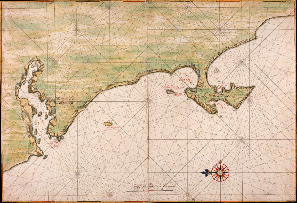
maps of the dutch east india company - south africa
1665
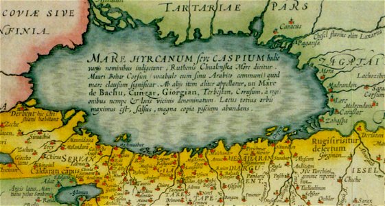
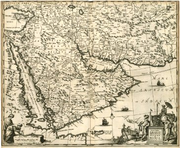
17th-century maps of the caspian sea
maps of persia by mercator-hondius
eran laor cartographic collection
richard william seale
collections of hauptstaatsarchiv stuttgart
1651 maps
old maps of the dutch east india company
1680
maps of goa by braun & hogenberg
maps of diu by braun & hogenberg
media from the national library of finland
classicism
everett d. graff collection of western americana
george woolworth colton
old maps of algiers
maps from gallica
a map of the provinces of new york and new jersey, with a part of pennsylvania and the province of quebec
lawrence h. slaughter collection of english maps, charts, globes, books and atlases
a map of the provinces of new york and new jersey, with a part of pennsylvania and the province of quebec
lawrence h. slaughter collection of english maps, charts, globes, books and atlases
a map of the provinces of new york and new jersey, with a part of pennsylvania and the province of quebec
lawrence h. slaughter collection of english maps, charts, globes, books and atlases
maps from university of amsterdam special collections
atlas der neederlanden
maps from university of amsterdam special collections
atlas der neederlanden
maps from university of amsterdam special collections
atlas der neederlanden
maps from university of amsterdam special collections
atlas der neederlanden
maps from university of amsterdam special collections
atlas der neederlanden
maps from university of amsterdam special collections
atlas der neederlanden
maps from university of amsterdam special collections
atlas der neederlanden
maps from university of amsterdam special collections
atlas der neederlanden
maps from university of amsterdam special collections
atlas der neederlanden
maps from university of amsterdam special collections
atlas der neederlanden
maps from university of amsterdam special collections
atlas der neederlanden
maps from university of amsterdam special collections
atlas der neederlanden
1401 - 1500 of 9,296
Next page
/ 93


![[Map of the complete island of Cuba]., Johannes Vingboons, 1639](https://cdn.creazilla.com/illustrations/6627474/map-of-the-complete-island-of-cuba-loc-2003623399-illustration-sm.jpeg)